Delhi-NCR’s hot, sticky day with patchy showers
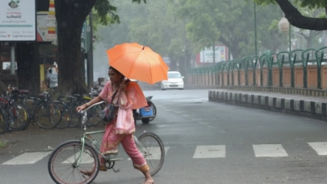
Delhi woke up to air so humid it felt like wearing a wet blanket. With the daytime high pegged at 35.6°C and humidity around 65%, the heat is set to feel far worse than the number on your phone. Dew points hover near 27–28°C — that’s the zone where a short walk can feel like a workout. Evening temperatures will ease to about 27.1°C, but the air will stay muggy.
The Weather Forecast for Wednesday points to scattered showers across the city, with an 89% chance of rain and around 1.47 mm of total precipitation expected. Showers are likely to pop up on and off from sunrise (5:56 AM) to sunset (6:48 PM). Winds near 15 km/h offer only slight relief. Translation: brief bursts of rain, quick surface cooling, and then the humidity snaps right back.
Why does it feel this oppressive? Two reasons. First, Delhi’s moisture-laden boundary layer is trapping heat. Second, weak winds reduce mixing, so the lower atmosphere stays thick and soupy. That’s also why the air can feel “stuffy” before a shower and fresher for a short window after it.
There is a notable shift lined up for Thursday (August 28): model guidance points to a much wetter day in the capital with about 32.74 mm of rain possible and temperatures ranging between 26.7°C and 35.2°C. If that pans out, expect longer spells of rain, slick roads, and waterlogging in the usual low-lying pockets.
Health-wise, the combination of heat and humidity increases the risk of heat exhaustion. If you’re stepping out in the afternoon, keep it short. Hydrate often, avoid heavy meals, and take breaks in shade or air-conditioning. For senior citizens, kids, and anyone with heart or respiratory conditions, the afternoon window (12–4 PM) is the riskiest.
Commuters should plan for uneven traffic: short, sharp showers can knock down visibility and create local flooding around underpasses, markets, and construction zones. If you ride two-wheelers, carry a light rain jacket. Drivers should watch for slick patches, especially where dust and oil mix with the first spell of rain.
Air quality can swing a bit. Pre-rain humidity and low mixing heights can make the air feel heavier, but showers often bring brief improvements by washing out dust. Expect patchy relief, not a clean sweep.
UP, Rajasthan and the south: What the sky is plotting
The larger monsoon setup is busy and complicated — and it explains the split-screen weather across India. A low-pressure area that formed over the northwest Bay of Bengal off the Odisha coast moved inland and weakened as it crept west-northwest. By August 28, it was centered over south Odisha and adjoining Chhattisgarh, still pumping moisture into central India.
The monsoon trough’s western end is near its normal position, while the eastern end sits south of its usual line. That tilt matters. It helps shift heavier rain west and southwest into Rajasthan and parts of Uttar Pradesh, while keeping a feed of moisture running across central India.
Layered on top is a Western Disturbance — a cyclonic circulation over north Pakistan and adjoining Punjab in the lower and middle troposphere. When a WD interacts with the monsoon trough, it can squeeze out intense rain in pockets along its path.
Result: East Rajasthan has already seen isolated extremely heavy rainfall this week. More rounds are possible, with thunderstorms and heavy downpours flaring along convergence zones. Urban areas should watch for flash flooding in poorly drained spots. Rural belts need to guard against sudden stream rises and ponding in fields.
Uttar Pradesh and Rajasthan: The rain signal stays strong midweek. Thunderclouds could build quickly in the afternoon and evening, especially where surface heating meets incoming moisture. Not every district will get hammered, but the ones that do can see intense, short-lived bursts.
Farm impacts: For Kharif crops (paddy, pulses, soy, cotton), rain is a mixed bag. Moisture replenishment helps in rain-shadow pockets, but waterlogging hurts young roots and raises pest risk. Farmers should clear drainage around fields, store inputs off the ground, and schedule spraying only when a 6–8 hour dry window is likely.
Shear zone watch: A mid-level shear zone running roughly along 17°N is energizing convection over peninsular India. That’s why the south has been loud and active on radar, and it’s not done yet.
South Peninsular India: Heavy to very heavy rainfall is on the cards, with extremely heavy falls very likely at isolated places over Telangana and coastal Karnataka. The outlook keeps heavy rain over Telangana for two days beyond August 28, and coastal Karnataka could see a longer stretch — up to six days of heavy to very heavy rain. Expect swollen streams, treefalls, and periodic travel delays along ghat sections.
Hydrology check: With multiple rain-bearing systems in play, small and medium rivers can swing fast. In Rajasthan’s eastern districts and parts of western UP, monitor local advisories for sudden rises. In the south, steep-banked streams respond quickly to cloudbursts; avoid crossing causeways during downpours.
Power, transport, and daily life: Intermittent rain days test infrastructure more than outright washouts. Drainage clogs, minor landslips on hill roads, and localized power outages are common. Keep devices charged, park vehicles away from trees, and avoid basement parking if your area floods easily.
For Delhi-NCR today, a practical plan helps. Think light clothes, electrolytes in your bottle, and a flexible commute. Toss a compact umbrella or poncho in your bag. If you work outdoors, try a split shift — mornings and late evenings — and rest during peak heat.
Numbers at a glance for Delhi (Aug 27):
- Day high: 35.6°C; Night low: ~27.1°C
- Humidity: ~65% (oppressive; high dew point around 27–28°C)
- Rain probability: ~89%; expected total ~1.47 mm
- Wind: ~14.8 km/h; light, not much cooling
- Sunrise: 5:56 AM; Sunset: 6:48 PM
What to do today:
- Hydrate before you feel thirsty; add salts if you sweat a lot.
- Avoid long workouts outdoors between noon and 4 PM.
- Use light, breathable fabrics; carry a small towel to manage sweat.
- For commuters: check radar or local alerts before leaving; rain bursts can be sharp.
- For families: keep a basic rainy-day kit — umbrella, power bank, flashlight, and medicines.
August snapshot: Across India, daytime highs this month have averaged near 33°C with very humid conditions. Many places clock around 10 rainy days in August and roughly 257 mm of total precipitation. This week’s setup fits that pattern — steamy in the north, stormy in the west and south, and a stronger rain day lining up for Delhi on Thursday.
Bottom line for North India: Delhi-NCR will shuffle between sweaty sunshine and patchy showers today; Uttar Pradesh and Rajasthan are primed for more meaningful rain, with East Rajasthan still at risk for very heavy spells. Keep plans flexible, and expect a wetter turn in Delhi on August 28.